Showing posts with label tollhouse. Show all posts

Wednesday, 23 May 2012

Hulverstone tollhouse

I have completed the individual page for the Hulverston tollhouse.


I managed to find a site about the history of the local area and linked it from the page.

The Newport tollhouse is next

Monday, 21 May 2012

Isle of Wight tollhouse page

I have made the county page for the Isle of Wight at my site, here. One of the tollhouses is a bit speculative as it is a bit modern but looks like it might be the place you are meant to pay for the chain ferry between the Coweses.

Individual pages for each tollhouse coming soon.


Monday, 7 May 2012

Collecting Isle of Wight tollhouses

Location: 4 Highwood Ln, Rookley, Ventnor, Isle of Wight PO38 3NN, UK
We spent the weekend on the Isle of Wight, mostly being wet and cold but also collecting as many of the island's tollhouses as we could find.

The map below shows what we managed to do.

Green dotted pins are tollhouses in the national database that we managed to photograph. The undotted green pin is a building that I believe is a toll house and photographed, but it is not in the national database. The red pin is a possible tollhouse, not in the database, but we didn't manage to stop and photograph it (streetview can be used to see it). The yellow pins are the two tollhouses we didn't manage to get to. The Yarmouth one I am not sure which building at the junction is the tollhouse, the St Lawrence one we just didn't manage to get to.

All the photos will be posted online over the next few days.


View Isle of Wight tollhouses in a larger map

Saturday, 21 April 2012

Final Tewkesbury tollhouse

I have completed the page for the Mythe tollhouses, Tewkesbury. The tollhouse and tollbooth stand at the eastern end of a bridge over the river Severn designed by Thomas Telford.


Tuesday, 17 April 2012

Ledbury tollhouse pages

I have added a page for each of the tollhouses in Ledbury that I photographed over the Easter weekend. I have also added a page of links to information about the Leominster & Ledbury Turnpike Trust.

The home page of my tollhouse website can be found here.


Monday, 16 April 2012

2nd Tewkesbury tollhouse

I have added a page for the second tollhouse in Tewkesbury here. This is a similar looking building to the Ashchurch gate tollhouse.


View Larger Map

Tewkesbury tollhouses

I have completed the page for the first of 3 (or 4, depending how you count) tollhouses in Tewkesbury, Gloucestershire. It can be found here.


View Larger Map

I will add the remaining 2 (3?) this week and then add the Ledbury, Herefordshire tollhouses. That will be all of the 5 I visited over easter and I will be ready for another trip to photograph some more.

Monday, 9 April 2012

Easter tollhouse hunt

Over the Easter weekend I managed to photograph a few more tollhouses. I found 3 in Tewkesbury, Gloucestershire, and 2 in Ledbury, Herefordshire. The partial maps for those counties are below.

I am in the process of producing the individual pages for each of these tollhouses on my site and will link to them from here once they are done.


View Herefordshire tollhouses in a larger map

View Gloucestershire tollhouses in a larger map

Monday, 26 March 2012

New Alresford tollhouse

I have added a page for the New Alresford tollhouse to the site here.

Although I have not yet taken any pictures of this tollhouse I have managed to find an old photo of it in the Hampshire County Council archives and also added a link to the English Heritage site giving the details of its listed status.

HCC have 7 other photos of tollhouses (returned by an archive search on "tollhouse") but none of these seem to be still standing.

Sunday, 26 February 2012

Some Hampshire tollhouses

Emily and I went for a drive this afternoon and visited 4 of the tollhouses in our local area.

First was the one I used to live in, in Chineham, Basingstoke.


Then we went down the B3400 to Whitchurch.


Then headed south of Andover to Wherwell.


And finally north of Andover to Hurstbourne Tarrant.


I will upload more photos to the relevant tollhouse pages over at my tollhouse wiki

Collecting photos

Location: A33, Chineham, Hampshire RG24, UK
Emily and I are spending the afternoon photographing some of our local tollhouses

Tuesday, 21 February 2012

Hampshire tollhouse locations

I have completed my initial search of sources to find as many tollhouses as I can in Hampshire. The results are stored in a kml file here. This can be downloaded and opened in Google Earth or imported into Google Maps. If you do the latter it should give you a view that looks like the map below:


View Hampshire tollhouses in a larger map


I now have to choose the next county to work on. If any readers have a preference let me know, otherwise I will probably start with one of Hampshire's neighbours and then work onwards from there.

Thursday, 16 February 2012

National Road - USA

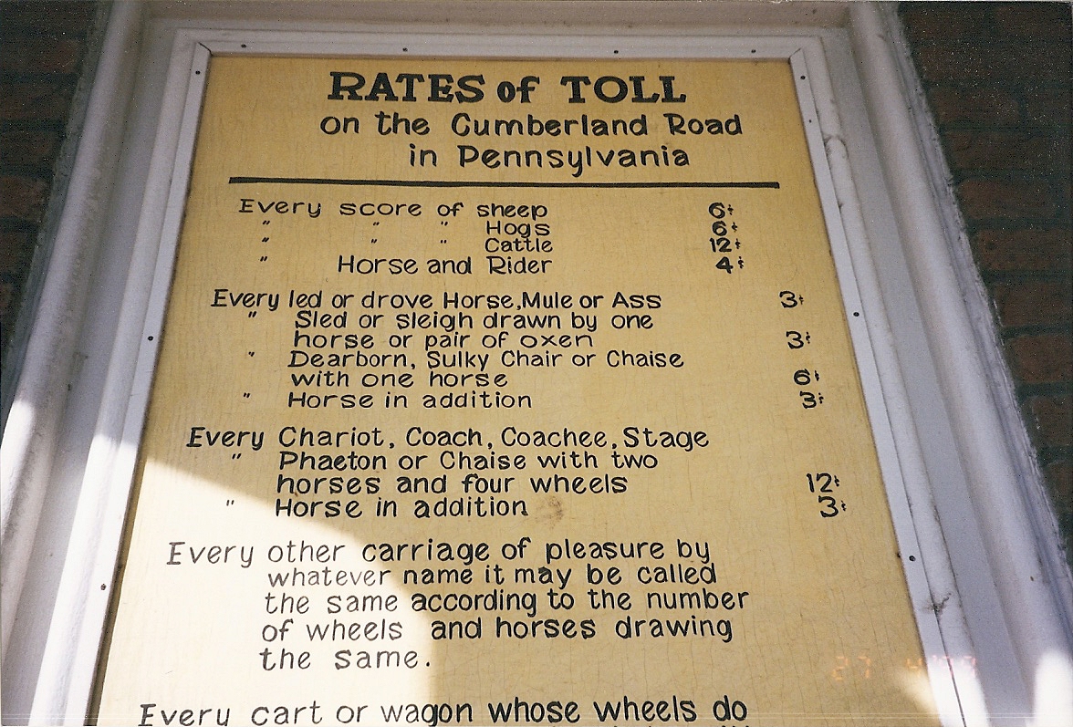
The National Road was the first federally built road in the USA, it is now mostly known as route 40. Wikipedia has a nice page on the road here. From reading that page it seems that three tollhouses remain on the road, one in Maryland and two in Pennsylvania. I have pictures of two of them.

Maryland tollhouse, Lavale


I visited this one February on week-long drive I took from Boston to Washington via Niagara and Pittsburgh. I have added it to the rest-of-world map page and you can also find it on the map below


If you zoom the map out you will see that this one is well placed in a gap in the hilly ridge, making it one of the few routes to drive livestock or carriages from one side to the other.

Pennsylvania "Searight's Tollhouse"

I didn't actually take these pictures myself, my parents spotted the tollhouse and took them for me.

They clearly went there on a much warmer day!


I like the "...whatever name it be called..." bit to ensure no one can sneak a vehicle past by claiming it doesn't appear on the list.


Both of these tollhouses seem to be constructed to the same plan, but the Maryland one is rendered whereas the Pennsylvania one is left at the natural brick finish. The third remaining tollhouse is the Petersburgh tollhouse in Pennsylvania. I don't have my own photos of that one but if you look at streetview on google maps other people have.


If you look at the photos you will see that again the plan is the same, but this time the building is of stone construction and is not rendered.

Wednesday, 15 February 2012

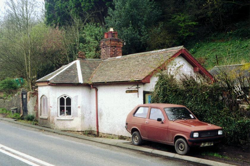
Near Hay-on-Wye

Location: Whitney Bridge, Hereford, County of Herefordshire HR3, UK
A couple of tollhouses I spotted near Hay-on-wye.

The first is controlling a tollbridge:


Don't be fooled by the dubious road surface, this is actually the B4350 although there is a speed restriction over the bridge.

As with all the pictures I am posting, the locations of these tollhouses is marked on the map on the UK map page.

The second pic from the Hay-on-Wye area is taken just outside Hay itself.


This tollhouse is on the B4350 again and is now a children's bookshop with a website here.

Near Malvern

Location: A449, Malvern, County of Herefordshire WR13, UK
OK, I have found more of my older pics of tollhouses.
This one is near Malvern, on the A449. Another picture can be found here, not much different to mine apart from the colour.

Listing details - Chineham tollhouse

Location: A33, Chineham, Hampshire RG24, UK
The national heritage listing for the Chineham tollhouse can be found here.

The description of the house in the list is a bit out of date. The original listing date is in 1984, so it must be after that time that the house was extended.

English Heritage give some advice on what you can do if you own a listed building here.

English Heritage did a photographic survey of all listed buildings in the early part of the 21st century. The Chineham tollhouse's page can be found here.

The Chineham tollhouse

Location: Chineham, Hampshire, UK
This is the tollhouse in Chineham, on the A33. It was at the southern end of the Reading-Basingstoke turnpike.


The octagonal building on the right is the original tollhouse. The wooden centre section and second octagonal building make up the extension, built 25-30 years ago. According to the deeds the road originally ran right up to the wall, in fact the house projected into it. A parcel of land was bought and attached to the property to allow garden all around the building. The current A33 runs behind the fence just visible on the far right of the picture.


The original part of the building is Grade II listed apparently.